Vadose zone/aquifer characterization
Saturated/unsaturated flow modeling
Quantification of recharge rates
Pilot recharge project design and monitoring
Infiltration basin monitoring
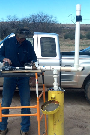
Design and installation of groundwater monitoring and production wells
Aquifer tests
Surface water – groundwater interaction
Geographic Information Systems
SOIL AND GROUNDWATER INVESTIGATIONS
GSA has conducted feasibility studies on over 30 groundwater recharge projects in the western United States, with a total recharge capacity exceeding 500,000 acre-feet per annum. GSA specializes in the design and installation of innovative vadose zone and groundwater characterization systems that eliminate the need for aquifer recharge pilot project studies. In addition, we have published numerous manuscripts on groundwater recharge processes and study methods and instructed short courses on siting groundwater recharge projects. Furthermore, GSA has provided technical services to evaluate groundwater resources, surface water-groundwater interactions, and the effect of urbanization on natural groundwater recharge rates.
Project Examples
- Groundwater Utilization Study, Klamath Water and Power Agency, Oregon and California
- Soil Moisture Monitoring, Palo Verde Ecological Reserve, California
- Aquifer Recharge and Water Resource Assessment, Walla Walla Basin Watershed Council, Oregon and Washington
- Groundwater and Soil Salinity Monitoring Network for Riparian Habitat Restoration Sites, Lower Colorado River Multi-Species Conservation Program, US Bureau of Reclamation, Arizona and California
- Groundwater/Surface Water Interaction Studies, Lower San Pedro River Preserve, Arizona
- Recharge Water Sediment Removal Feasibility Study, Orange County Water District, California
- South Avra Valley Storage and Recovery Project, Tucson Water, Arizona
- Supplemental Hydrogeologic Study for the New River Aqua Fria Aquifer Storage and Recovery Project, Salt River Project, Arizona
- Assessment of Increased Recharge due to Urbanization and Stormwater Detention, City of Chandler, Arizona
- Stormwater Control and Recharge Potential, Coshise County, Arizona
- Riparian Restoration Site Soil Moisture and Irrigation Monitoring, Lower Colorado River Multi-Species Conservation Program, US Bureau of Reclamation, California